William Emory mapped the U.S.-Mexico border — here’s how an Army officer plotted the future of U.S. expansion
Raised in a prominent Chesapeake Bay family, William Emory was a gifted mapmaker with a scientific mind. He shaped the borders of the nation as it expanded westward.
William H. Emory shaped the United States like few Americans before or since.
The U.S. Army officer fought to expand the physical shape of the nation in the Mexican-American War.
Emory later defied local and family sentiment in his home state of Maryland, rejecting offers from the Confederacy. Instead, he fought for the Union in the Civil War.
MEET THE AMERICAN WHO WAS THE ‘WORKING MAN’ FOUNDING FATHER, IRISH IRONSMITH GEORGE TAYLOR
He helped shape the future America as a nation without slavery. The U.S. shed the institution nearly a century before Europe and Asia, which were consumed by slavery and genocide as recently as 1945.
Emory is best known for his work in between the wars with the U.S. Army Corps of Topographical Engineers.
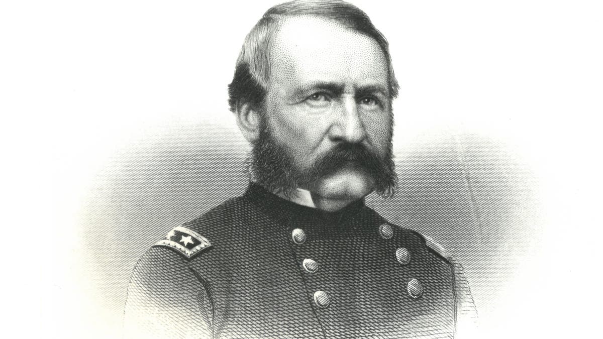
William H. Emory as a major general in the U.S. Army during the Civil War. Emory graduated from the U.S. Military Academy at West Point in 1831. He is best known for his work in mapping the U.S.-Mexico border in the 1850s. (Courtesy of USMA Library Archives and Special Collections)
Emory gave the map of the United States the shape we know today.
He led expeditions that surveyed the U.S.-Canada border and then, following the Gadsden Purchase in 1854, plotted some 2,000 miles of the U.S.-Mexico border in the south.
"William Emory was a fascinating man," Matthew Walter, retired curator of the Museum of the Big Bend in Alpine, Texas, told Fox News Digital.
Emory's "boundary survey is one of the greatest events in U.S. political history and remains deeply present in our contemporary lives."
"He didn’t just map the border, he brought scientists. He brought artists. He did an amazing job."
Emory himself named a sweeping loop in the Rio Grande the Big Bend. Today it's the home of a namesake national park and is dubbed "Texas' Gift to the Nation" for its natural beauty.
Emory brought back images that shape our own view, and the world’s view, of the United States today.
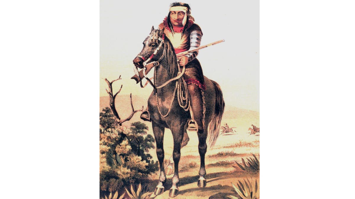
Lipan Apache warrior from "United States and Mexican Boundary Survey. Report of William H. Emory," Washington, D.C., 1857. (World History Archive/Alamy Stock Photo)
Among them: the vast expanses of the Rio Grande, the frontier outpost of Fort Davis, and the Plaza and Church of El Paso, now on the Mexican side of the border.
Each location has been recast in pop culture and in the popular history of the American Southwest for generations.
MEET THE AMERICAN WHO FOUGHT AND BLED AT THE ALAMO BUT LIVED TO TELL ITS HEROIC TALE: SLAVE JOE
Emory also brought back, Walter noted, "the first image ever of a Lipan Apache Indian."
The Army officer even shaped the struggles the nation faces today. The U.S.-Mexico border is currently the scene of a humanitarian and national security disaster. More than 2 million people illegally crashed over the border last year — and millions more keep coming.
It's the same border Emory plotted in painstaking detail, with primitive equipment and methods by today's standards, and recorded every foot in scientific detail to share with the world.

The U.S.-Mexico border mapped by William Emory and his expedition in the 1850s has become the scene of a current humanitarian disaster and national security threat, with millions of illegal immigrants crossing each year. (Christian Torres/Anadolu via Getty Images)
"The mid-19th century survey of the 2,000-mile border was a story of heroism, skill and endurance of epic proportions," University of Southern California geography professor Michael Dear wrote in 2005 for Prologue Magazine, published by the National Archives.
"Though lacking the glamour of war or the grandeur of the Lewis and Clark expedition, the boundary survey is one of the greatest events in U.S. political history and remains deeply present in our contemporary lives."
‘Bold Emory’
William Hemsley Emory was born on Sept. 7, 1811, to a prominent family in Queen Anne’s County, Maryland.
"His father Thomas Emory was a prominent politician and businessman, who groomed William for the military from a young age," according to a report in the Maryland State Archives.
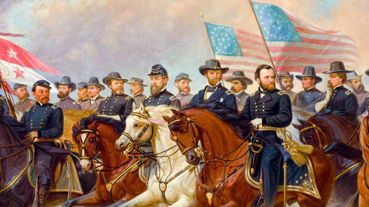
Commander of the Union Army, Ulysses S Grant, his head uncovered between flags, and his generals. Maj. Gen. William H. Emory appears at far left, under the red-and-white banner. Gen. William T. Sherman is to the left of Gen. Grant, on a white horse. Equestrian portrait painting by Ole Peter. (Alamy Stock Photo)
Future Confederate president Jefferson Davis was among his childhood friends, and possibly even his cousin, the state archives notes.
Emory made his way to the U.S. Military Academy at West Point, graduating in 1831, two years after fellow cadet Robert E. Lee.
"His father Thomas Emory was a prominent politician and businessman, who groomed William for the military from a young age."
The scion of Maryland elite apparently displayed a streak of daring and bravado. He was dubbed "Bold Emory" by his classmates.
He also proved a gifted student.
"He so impressed his professor [Alexander Dallas Basche] at West Point that he got to marry the professor’s sister," said Walter.
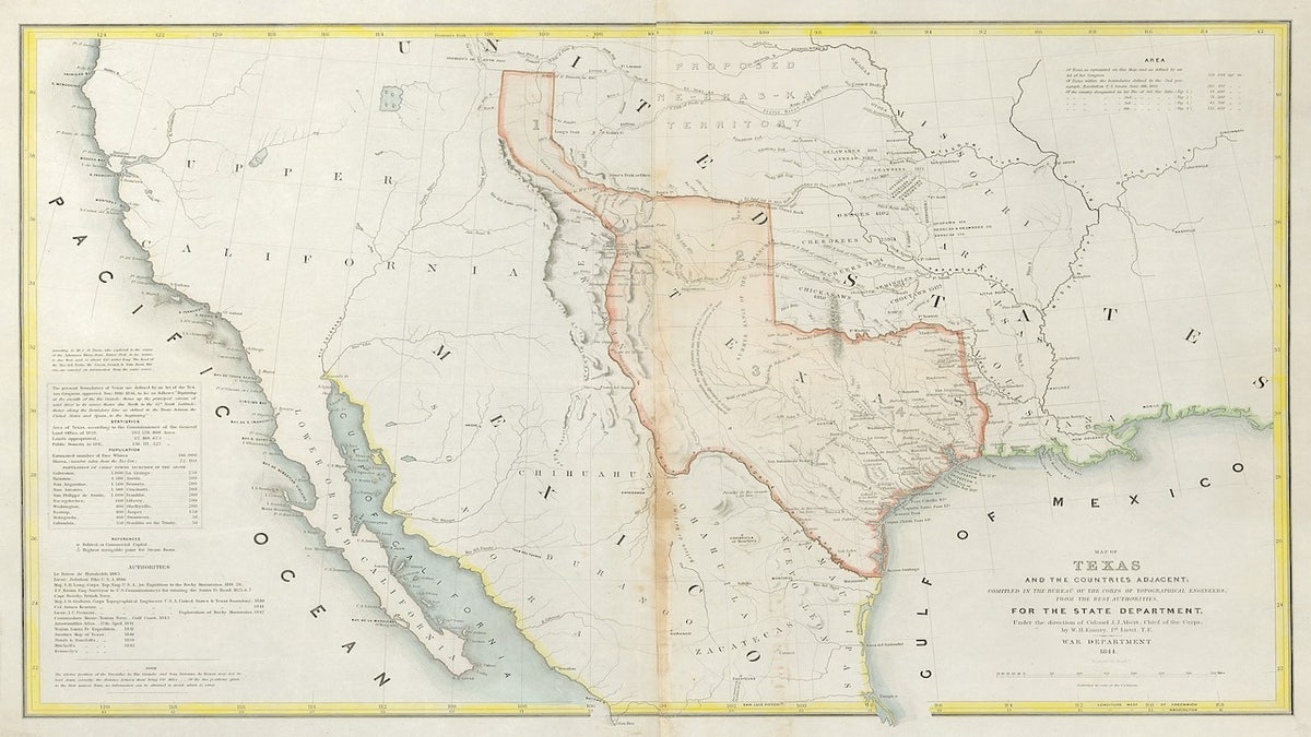
A map made by General Emory in 1844 in preparation for the U.S. government preparing to welcome the Republic of Texas into the Union. (Courtesy of UTA Special Collections)
Professor Bache and his sister, Matilda Wilkins Bache, were Ben Franklin’s great-grandchildren.
Their uncle, George M. Dallas, served as vice president of the U.S. under President James K. Polk (1845-49) and is considered, in a disputed account, the namesake of the city of Dallas.
It was under the Polk-Dallas administration that the United States underwent its greatest period of expansion, pursuing its "Manifest Dynasty."
‘Long-standing contribution’
Texas won its independence from Mexico in 1836, which ignited a chain of dramatic events in the history of North America.
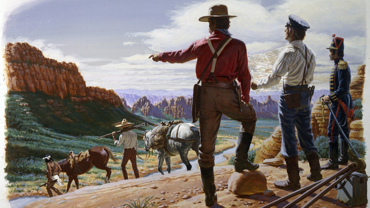
A painting depicting surveyors mapping out the territory in what is now Arizona and New Mexico that would be transferred from Mexico to the U.S.A. in the Gadsden Purchase in 1853 in Arizona. (Illustration by Ed Vebell/Getty Images)
Texas joined the Union in 1845, which led to an invasion by Mexico to reclaim the territory that rejected it.
The U.S. victory in the Mexican-American War that followed ended with the Treaty of Guadalupe Hidalgo (1848). It expanded United States territory all the way to California.
The Gadsden Purchase of 1854 secured a strip of what’s now southern New Mexico and Arizona and completed the expansion of what’s now the lower 48 states.
MEET THE AMERICAN WHO ROWED WASHINGTON ACROSS THE DELAWARE ON CHRISTMAS: SAILOR-SOLDIER JOHN GLOVER
Emory earned distinction with the U.S. Army Corps of Topographical Engineers during the war with Mexico, which gave him familiarity with what’s now the border region.
He was sent to lead the expedition to survey the nation’s new lands and set the international border with Mexico. The Army veteran was essentially sent to settle the long-simmering dispute.
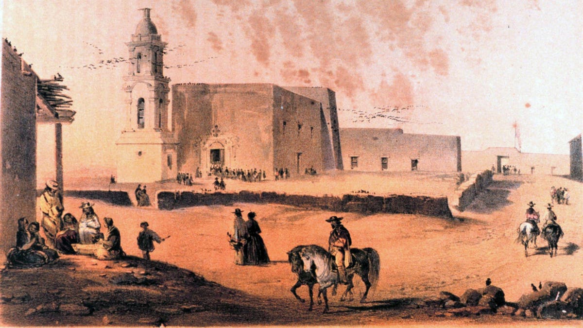
The Plaza and Church of El Paso, from "United States and Mexican Boundary Survey. Report of William H. Emory," Washington, D.C., 1857. (World History Archive/Alamy Stock Photo)
"All told, the first boundary commission comprised 39 people and had an army escort of 105," Civil Engineering magazine reported in a 2014 recount of the epic engineering feat.
The publication noted that Emory was "a gifted topographical engineer and resourceful leader able to navigate both the treacherous landscape of the Southwest and the equally treacherous politics of the job."
Emory was "able to navigate both the treacherous landscape of the Southwest and the equally treacherous politics of the job."
It was laborious work using primitive tools and methods by today’s standards — including chronometers, sextants and the heavens themselves, noted Walter of the Museum of the Big Bend.
"They stopped to build survey stations, tall enough to find the horizon and mark it by measuring the angle to certain stars," the retired curator said.
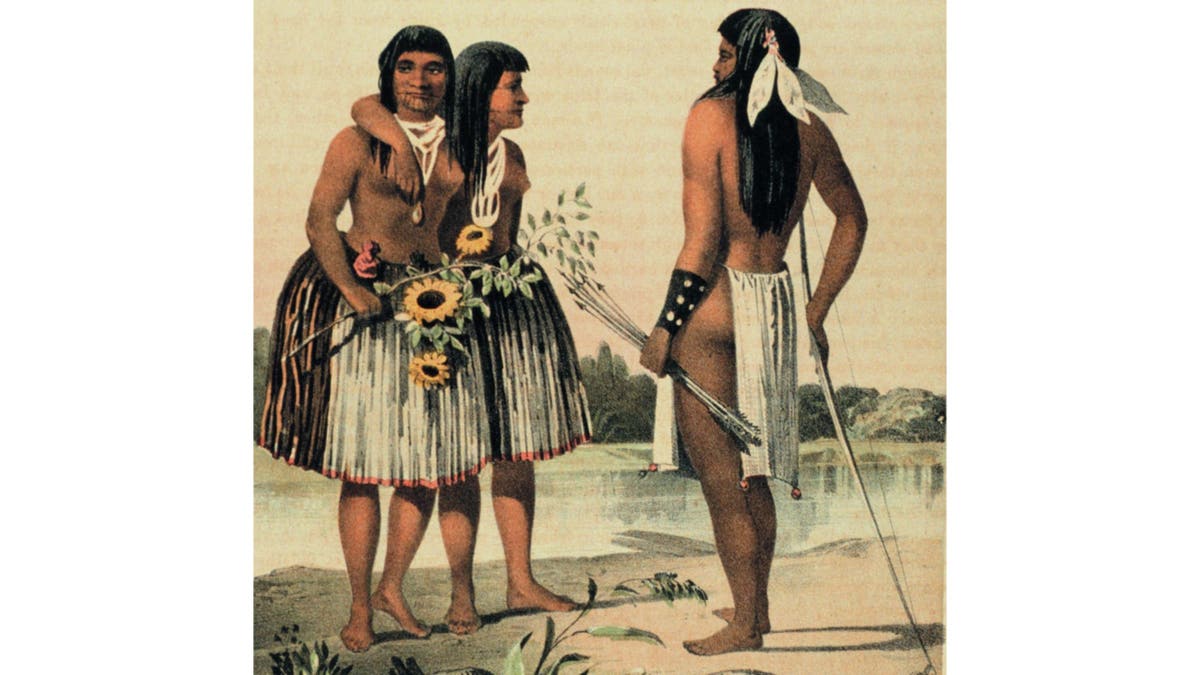
Yumas tribesmen, from "United States and Mexican Boundary Survey. Report of William H. Emory," Washington, D.C., 1857. (World History Archive/Alamy Stock Photo)
The survey stations were then disassembled and transported to the next location to take measurements.
The distance might be 10 miles away on flat land, just a half mile on rugged land, said Walter.
Starting in San Diego and moving east, the team recorded every measurement along the way, to be transcribed and published upon completing the mission.
The team also recorded the geology, biology, wildlife — and human life — found along the way.
It also mapped every source of fresh water. Those same locations were later made the stops on the southern tier of the transcontinental railroad.
American cities sprouted along the railroad stops that grew up around Emory’s watering holes, Walter noted.
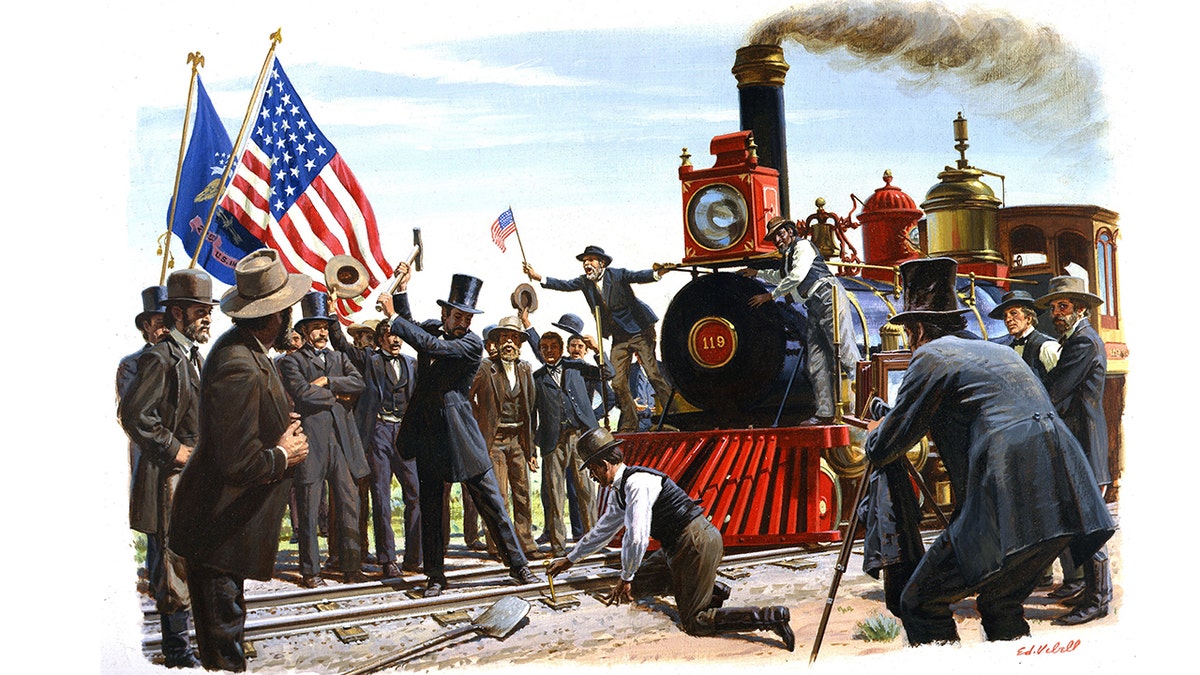
A painting depicting the ceremonial driving in of "the golden spike" at the meeting of the Central Pacific and Union Pacific Railroads on May 10, 1869, in Promontory, Utah. The southern tier of the transcontinental railroad was built along points mapped out by William Emory during his 1850s border expedition. (Illustration by Ed Vebell/Getty Images)
His voluminous "Report of the United States and Mexican Boundary Commission, Made Under the Direction of the Secretary of the Interior" was published between 1857 and 1859.
It "was not only a contribution to understanding the geography of the region but was a long-standing scientific contribution to the natural history of the region," David Norris wrote in his 1998 biography, "William H. Emory: Soldier-Scientist."
America ‘hereafter without me’
Maj. Gen. William Emory died in Washington D.C. on Dec. 1,1887. He was 76 years old.
He had left the Army but returned during the Civil War, leading regiments in the Army of the Potomac and as far away as Louisiana.
The veteran of two wars is buried in the capital city’s Congressional Cemetery.
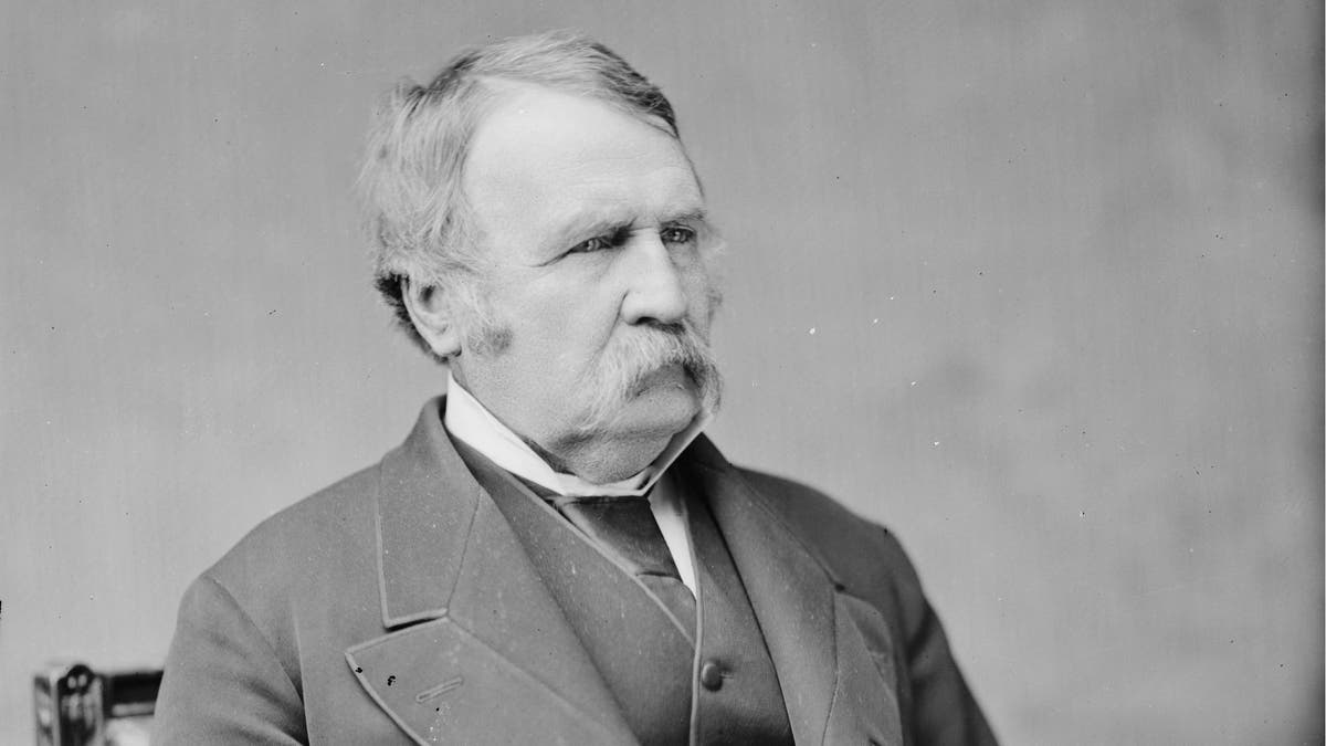
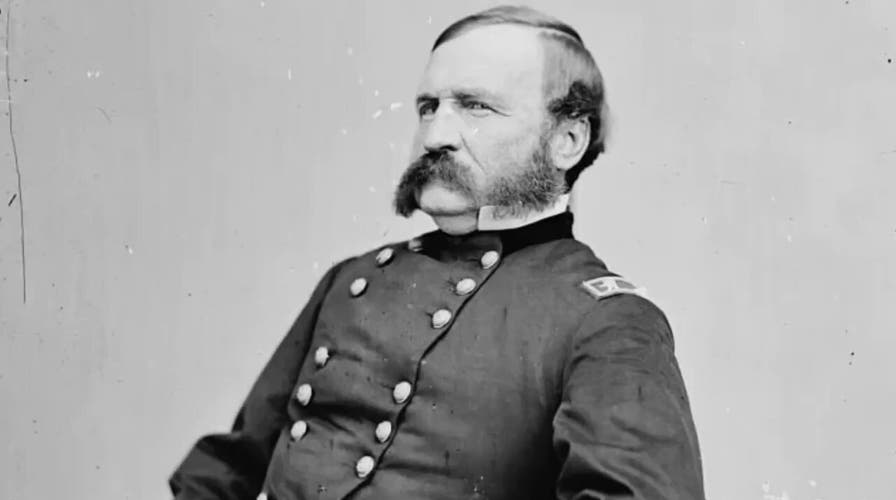
U.S. Gen. William Emory. The surveyor and civil engineer mapped and wrote about America's borders. From the Library of Congress Prints and Photographs Division. Brady-Handy Photograph Collection. (Mathew Benjamin Brady/Levin Corbin Handy - Library of Congress/Public Domain)
Among the distinguished Americans buried there are Declaration of Independence signer and vice president Elbridge Gerry, patriotic composer John Philip Sousa and Apache chief Taza, son of famed warrior Cochise.
Taza was a boy of about 3 or 4 years old when Emory led his expedition through Apache territory and brought back the first images of the tribe seen in the United States.
"Is it possible … the joyous embrace of the living victors, is all to be done hereafter without me?"
Emory has been honored in the flora and fauna of the American soil in the farthest reaches of American exploration.
Emory and the Latinization of his name are used throughout science. The rugged desert shrub Emory’s crucifixion thorn (Castela emoryi), the Texas spiny softshell turtle (Apalone spinifera emoryi), the Great Plains rat snake (Pantherophis emoryi) and the devil cholla cactus (Grusonia emoryi) are all named for him.
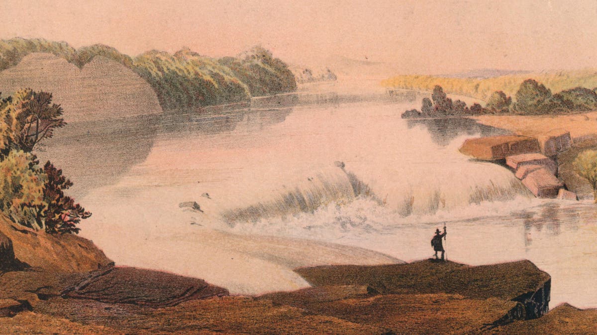
View of the falls on the Rio Salado, a tributary of the Rio Grande, in New Mexico. From "Report on the United States and Mexican Boundary Survey," by William H. Emory, C. Wendell, Washington,1857-1859. "Falls of the Rio Salado" by Sarony, Major and Knapp. (The Print Collector/Alamy Stock Photo)
Emory Peak is the tallest mountain (7,825 feet) in Big Bend National Park, but not as high as Emory Pass (8,228) in New Mexico.
The U.S. Army named Fort Emory, a coastal defense battery in Coronado, California, in his honor in 1942.
CLICK HERE TO SIGN UP FOR OUR LIFESTYLE NEWSLETTER
It was transferred to the U.S. Navy after World War II and is now known as the Silver Strand Training Complex.
Fort Emory, according to the Navy, "has become the premier training facility for the military special forces."
Most notably, the former Fort Emory is where U.S. Navy SEALs train, just a few miles from the U.S.-Mexico border.
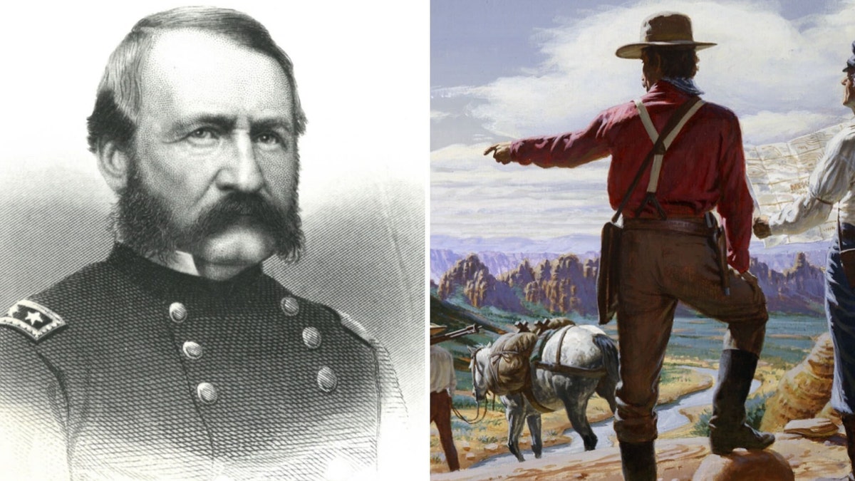
Maj. Gen. William Emory served in both the Mexican-American War and the Civil War. Between those two wars, he led the expedition to survey the U.S. border with Mexico, as illustrated on right. (USMA Library Archives and Special Collections; Illustration by Ed Vebell/Getty Images)
The crew of Apollo 17, which included U.S. Navy pilots Gene Cernan and Ronald Evans, named the moon’s Emory crater for their fellow military explorer in 1972.
CLICK HERE TO GET THE FOX NEWS APP
Emory, in his old age, appeared prophetically worried about the fate of the nation whose borders he set.
"Is it possible," he wrote in his unfinished memoirs, "that the long march, the dreary watch, the exciting skirmish, the glorious and eventful battle, the bivouac at night, the pursuit of the enemy … the joyous embrace of the living victors, is all to be done hereafter without me?"
To read more stories in this unique "Meet the American Who…" series from Fox News Digital, click here.
For more Lifestyle articles, visit www.foxnews.com/lifestyle.
